Holkham NNR – Central Area – Lady Anne’s Drive and Wells Beach
Warning: This is a coastal reserve. At High Spring Tides the sea completely covers the bay at Holkham Gap, right up to the sand dunes. For any visit always check the predicted tide times. A link to tidal predictions for Wells is available on the Holkam NNR website (see the ‘Nature Reserve and Beach’ tab).
Reserve name: Holkham NNR – Central area (see also separate reports on Holkam NNR at Burnham Norton, Burnham Overy Staithe, and Eastern section)
Location: This central part of the NNR extends from the main coast road, the A149, northwards across the grazing marshes to the dunes (which are mostly covered with pines) and beyond to the sea. It is mostly easily accessed from two car parks – Lady Anne’s Drive in the centre of this section and the Wells Beach Road car park at its eastern end. Both are owned and administered by the Holkham Estate. It is possible to access this section via the Coast path from the west, but that is a walk of over 5 kms, most of it not wheelchair accessible.
Please do not try to gain access to the section of the NNR to the east of Wells by crossing the channel at Wells Beach. This is only possible at very low tide, and anyway only gives you access to the East Hills area. Every year coast guard rescues have to be made for people who ignore warning signs! Getting from East Hills to the coast path east of Wells requires detailed local knowledge of a changing route across the creeks and a high degree of mobility!
Contact details: See Holkham NNR Overview
Map reference: TR 891448 (Lady Anne’s Drive)
TR 913453 (Beach Road car park)
Google Map: Lady Anne’s Drive
Opening hours: This part of the reserve is open 24 hours a day, but the car parks close (with gates/barriers) at 6pm between October and March.
Public Transport Links: Nearest mainline train stations at King’s Lynn or Sheringham. From King’s Lynn bus station (several hundred metres from the train station), and Sheringham train station the Coast Hopper bus service runs along the A149 coast road. Coast Hopper details can be found HERE or search for Coasthopper in your internet search engine. Note that timetables vary according to the season, and that sometimes when travelling from King’s Lynn a change of bus is necessary at Hunstanton. The nearest bus stop is at The Victoria Inn, Holkham, on the A149. The bus stop is a short distance from the entrance to Lady Anne’s Drive, which is about 800 metres long, with a tarmac surface.
For the Beach Road car park at Wells the nearest bus stop is on Freeman Street (B1105), near the junction with Beach Road. This is about 1.5kms from the NNR. There is a miniature railway running parallel to Beach Road, but this only runs during the tourist season, and has not been surveyed for accessibility.
Parking: Parking is available at Lady Anne’s Drive and Beach Road, Wells. Both can be very busy in the holiday season, and at weekends at any time of year.
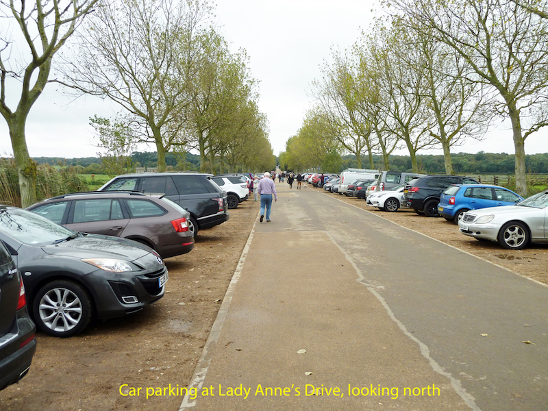
There are some designated blue badge spaces at the seaward end of Lady Anne’s Drive, on the eastern side. This is a temporary location due to work on the new Orientation Centre, but these spaces do have a compacted surface. At Beach Road there are 6 spaces near the entrance to the car park, along the road leading to the café. They are marked with yellow lines.
Both car parks operate on a Pay and Display basis, and in early October 2017 charges were as follows:
Lady Anne’s Drive
Up to 1 hour £2
Up to 2 hours £3
Up to 4 hours £5
All Day £7
Beach Road
Up to 1 hour £2
Up to 2 hours £3.50
Up to 4 hours £6
All Day £8.50
Ticket machines are at a convenient height for wheelchair users.
It would be possible to drop off passengers in either car park, but alternative parking places are some way off. There would normally be space for a minibus in either car park, though not at very busy times.
The car park surface at Beach Road is firm and well-drained, but at Lady Anne’s Drive it is mixed. The spaces at the northern end have a stone surface, but further south it is grass. Some of these tend to be soft and muddy in wet weather. Not surprisingly the northern ones, nearest the beach, tend to fill up first.
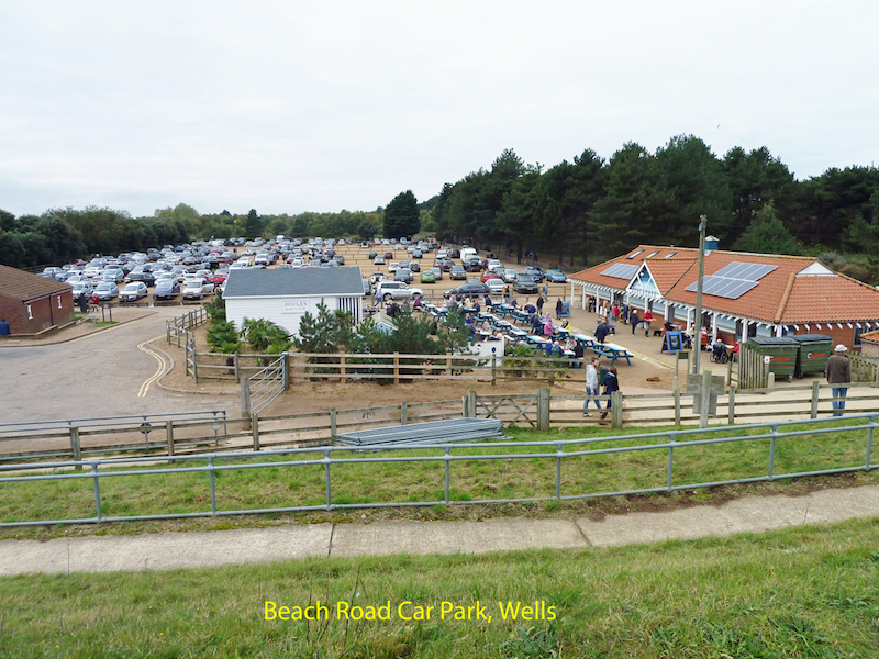
Toilets: There are currently no toilets at Lady Anne’s Drive, but this will change once the new Orientation Centre opens in 2018. The nearest accessible public toilets with RADAR locks are located on Beach Road, in Wells, opposite the Harbour Office. There are also accessible toilets in the Beach Road car park – managed by Holkham Estate. Beach Road car park also has a dog-friendly café serving light lunches and snacks and hot drinks.
Wardens: There are wardens on duty during most working hours, but this is a very large reserve and they may be working on other parts of it. See contact details. There is an information kiosk at Lady Anne’s Drive that was staffed on the day of survey. This is going to change in 2018 – see section on Visitor Centre below.
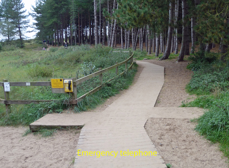
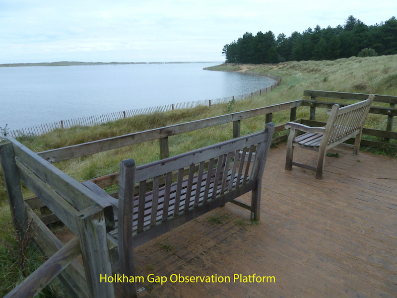
Public Telephone: There are no public telephones on the NNR, but there is an emergency telephone on the board walk at Holkham Gap (see details and photo below). Mobile phone signals along this coast are often low strength or non-existent, and should not be relied on.
Visitor Centre: There is currently no Visitor Centre anywhere on the Reserve, but work started in September 2017 on building a new Orientation Centre at the northern end of Lady Anne’s Drive. This is due to open in June 2018, and will have toilets and refreshment facilities, views over the grazing marsh, and will be staffed by wardens. Details can be found on the Holkham website, on the Property-Planning and Development tab.
Dogs: Dogs are permitted on the reserve, but should always be under close control. Holkham Estate has a strict “Bag it and Bin it” policy on dog waste, and bins are located at strategic points.
Trails and Paths
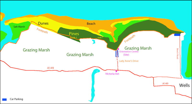
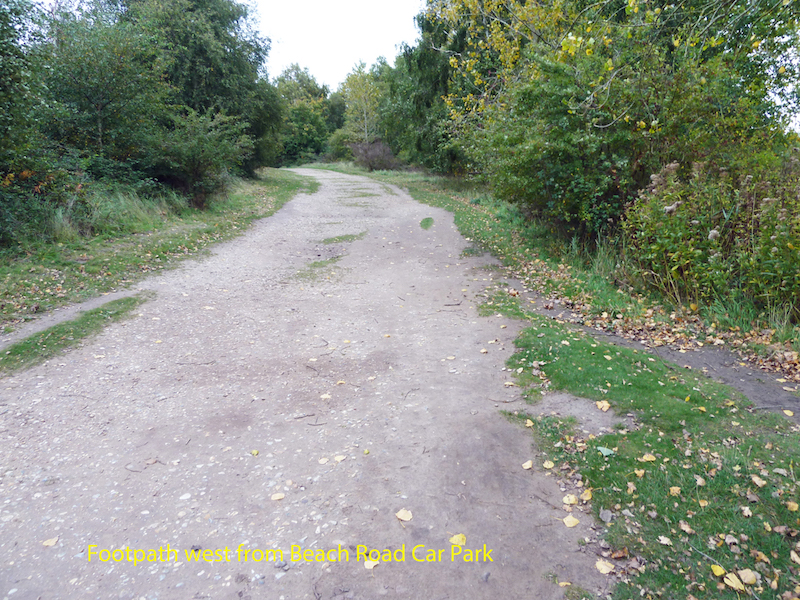
Access is not permitted anywhere onto the grazing marsh, although parts of it can be viewed from Lady Anne’s Drive, the two hides and the footpath south of the pines. This footpath is the most accessible, both in its location and physical details. It extends from the western end of Beach Road car park to the western end of the pines. There are also various paths that go into and through the pines from the main footpath, some of which may be wheelchair accessible before they climb up over the dune ridge.
Approximate distances are as follows:
From the Beach Road café near the entrance to the car park to the northern end of Lady Anne’s Drive – about 3 kms
From northern end of Lady Anne’s Drive to Hide 1 (Washington Hide) – 880 metres
From Hide 1 to Hide 2 (Joe Jordan Hide) – 850 metres
From Hide 2 to western end of Pines – 750 metres
Westward beyond the pines the path enters the dunes, and eventually leads to the area best accessed via Burnham Overy Staithe. The path through the dunes is not wheelchair accessible due to slopes, narrowness of the path and soft sand.
The footpath south of the pines is mostly firm sand or rolled stone. Some stretches, mainly near the car park ends of each section of path, are quite uneven/bumpy, with stones protruding. The path is generally quite level, with a few gentle undulations. These increase west of Hide 2. There is generally plenty of room for wheelchairs to pass.
Take care as the path goes through the pines – there are many tree roots crossing the path, creating potential trip hazards. However overhanging branches etc. are not a problem.
From the northern end of Lady Anne’s Drive a board walk leads through towards the sea. Most of this is unfenced, and there are no upstands at the edge. Beside the board walk is a wide path of soft sand. This is a route designated for horses, which are often taken to exercise on the beach here. So be aware that horses may be ridden past you at quite close distance!
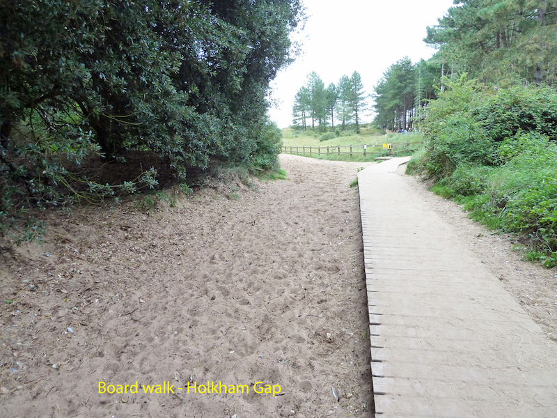
The board walk has a couple of passing places, near the emergency telephone situated where the fencing begins. Dialling 123 will connect you to the Emergency Services, just like dialling 999 from a standard telephone.
The board walk leads to an observation deck that looks out over the saltmarsh and beach to the distant sea – at low tide. The saltmarsh and beach can be accessed down a fairly steep board walk.
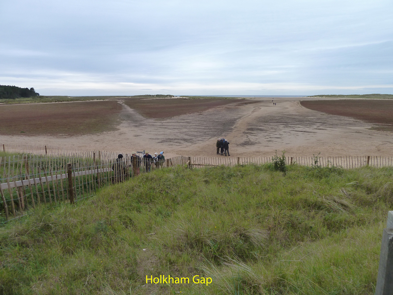
But at high spring tides the sea advances to across the whole of Holkham Gap, covering the saltmarsh and all the paths across and around it. This happens very quickly as the tide comes in. Do check your tide tables!
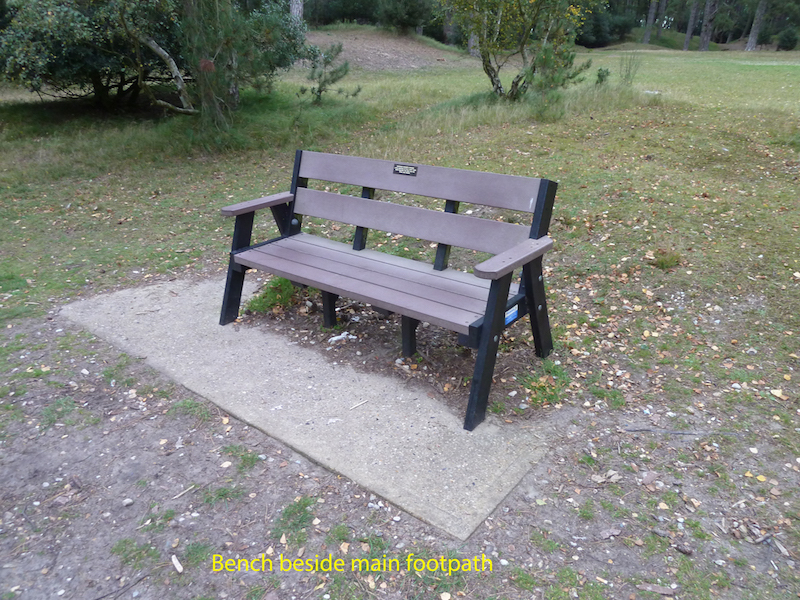
Resting places: Between the Beach Road car park and Lady Anne’s Drive there are a series of benches, spaced at intervals of about 600metres. They are all of similar pattern, 150cms wide, with seat height of 40 cms, and with arm and back rests. West of Lady Anne’s Drive there are four more benches, at slightly closer intervals, before you get to Hide 1.
Barriers
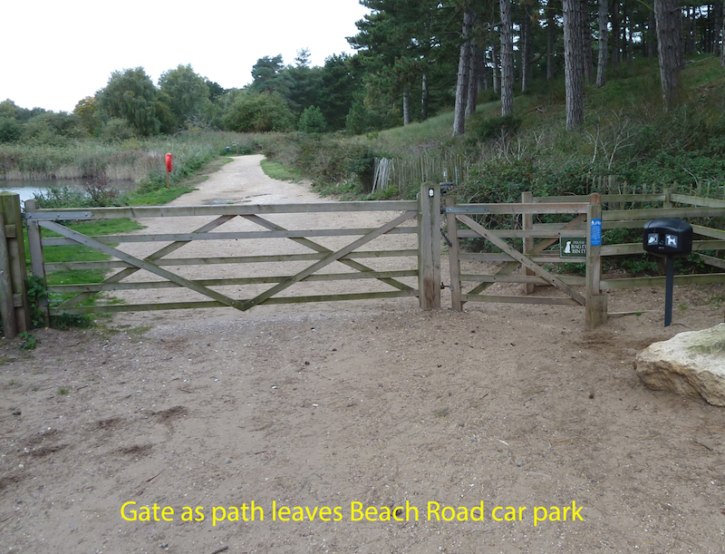
There is a gate across the path as it leaves Beach Road car park, heading towards Lady Anne’s Drive. The pedestrian gate beside the main vehicle gate has plenty of room to allow wheelchair access. It is spring-loaded, has no latch and the opening has a minimum width of 130 cms.
At the northern end of Lady Anne’s Drive access is currently somewhat disrupted by the building works for the new Orientation Centre. It was not clear exactly what gates, if any, will be in place on the path when the work is complete (estimated mid-2018). However the Holkham Estate is well aware of, and supportive of, the need for easy access for all.
Hides
There are two hides, both to the west of Lady Anne’s Drive.
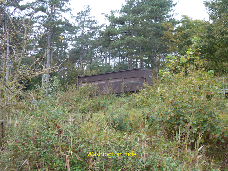
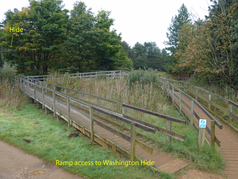
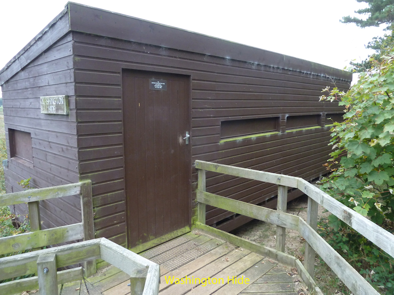
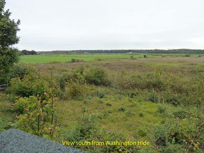
Hide 1 – Washington Hide
Washington Hide is accessed from the path just south of the pines. It is in an elevated position, with views south over the grazing marshes and reed beds. The access board walk is ‘dog-legged’ to reduce the gradient, but nevertheless each leg still measured at an angle of about 8 degrees. This gives a gradient of about 1 in 8 – considerably steeper than the recommended maximum of 1 in 12, and preferred 1 in 20. Solo wheelchair users might find this a hard push, though it could be managed with assistance. The sloped path has three ‘legs’, the lowest measuring 25 metres in length, the centre measuring 14 metres and the top leg 30 metres. There are level landings at the end of each leg, which also act as passing places. The board walk is about 110cms wide, with boards covered in wire mesh for grip, and having raised edges. The handrails are about 90cms high. All were in good condition in October 2017.
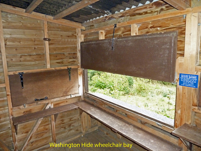
Inside the hide there is a wheelchair bay with unobstructed access directly opposite the door. It is about 160 cms wide, with a foot/knee space extending forward 65cms at floor level. There is a shelf about 65 cms from the floor and 23 cms deep, and 17 cms above that a viewing ‘window’ 42cms high. This combination should give good views out for most wheelchair users. Unfortunately, when surveyed in October 2017, there was a major issue with the way in which the flap covering the viewing ‘window’ is retained in the open position. A long hook hangs down to secure the flap from above, but this hinges at a height of over 180 cms. Not only is this out of reach of someone sitting in a wheelchair, it is compounded by the fact that if you raise the flap from the closed position the hook gets trapped behind the flap. This has been brought to the attention of the Conservation Manager, who is urgently looking to resolve this issue. There is also a flap on the left side of the wheelchair bay, at similar heights. This flap has a ‘turnkey’ retainer at a height of 175 cms, which is also too high for easy reach.
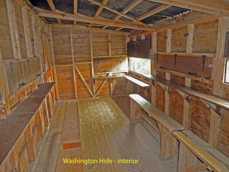
The rest of the hide has fixed seating on both sides, at a height of 40cms, with gaps that allow legs to pass through, without the need to lift them over the benches. The shelves are at a height of 93 cms, and are 13 cms deep. The openings are 17cms above the shelves, with an opening height of 28 cms.
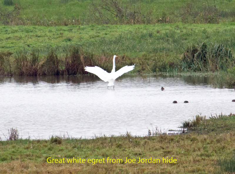
The hide gives excellent views to the front over the grazing marshes, reed bed and open water, though views are not close and telescopes are recommended. On the day of survey a great white egret was showing well.
To the rear there are much closer views into the pines and sycamores.
From outside the hide it is possible to follow a board walk north through the dunes to a viewing platform that looks out across lower dunes to the beach with distant views of the sea beyond. This board walk is of similar dimensions to the access ramp to the hide, and undulates fairly gently, with passing places.
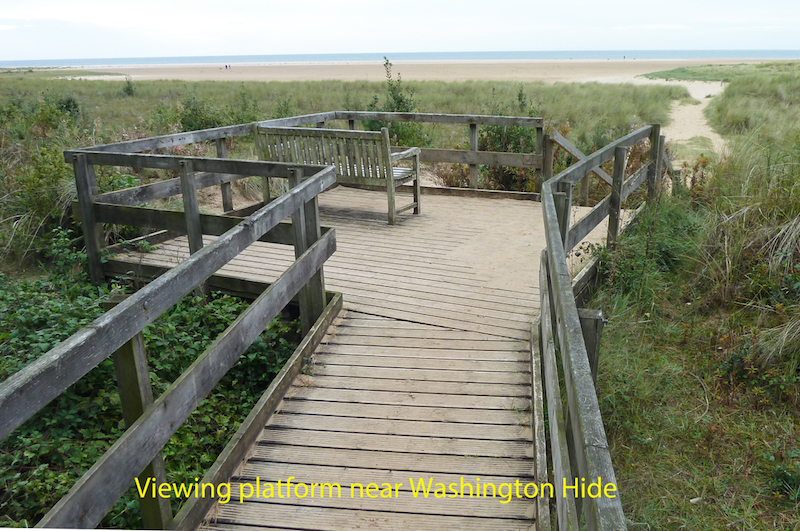
There is a bench on the viewing platform about 140 cms wide, with a seat hight of about 46 cms. From there 10 steps (85 cms wide with handrails 90 cms high) lead down to lower dunes. Blown sand on the steps can be an issue. For those who can manage the steps it is possible to walk east from here and back to Holkham Gap and Lady Anne’s Drive (a distance of just over 1km). Please do note that part of this path is flooded at high spring tides! Similarly it is possible to walk west, past the end of the pines, eventually reaching the sea wall that leads to Burnham Overy Staithe after about 3.5kms. A further 1.5 kms would lead you to the car park at Burnham Overy Staithe. Neither of these walks would be negotiable in a wheelchair.
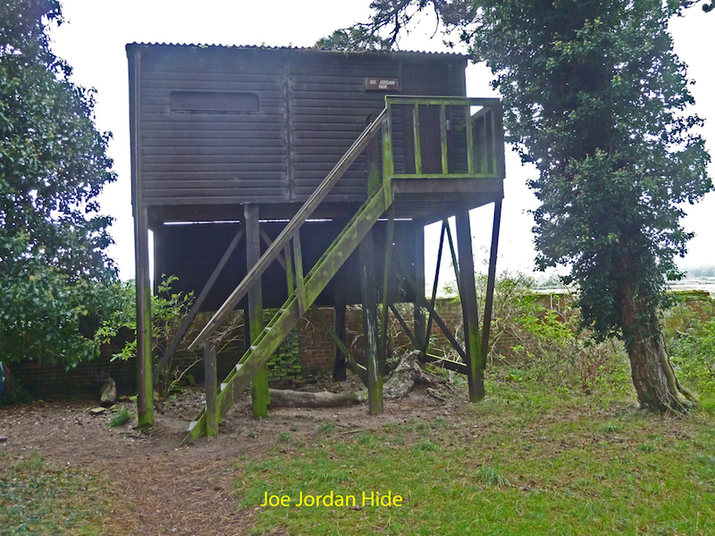
Hide 2 – Joe Jordan Hide
Joe Jordan Hide is located on the southern edge of the pines, about 900 metres further on from Washington Hide. It is an elevated hide, accessed by climbing 14 steps, so is not wheelchair accessible.
It has fixed benches with room to slide your legs in, and viewing slots with shelves at comfortable heights. The door opens inwards, and has a lever handle.
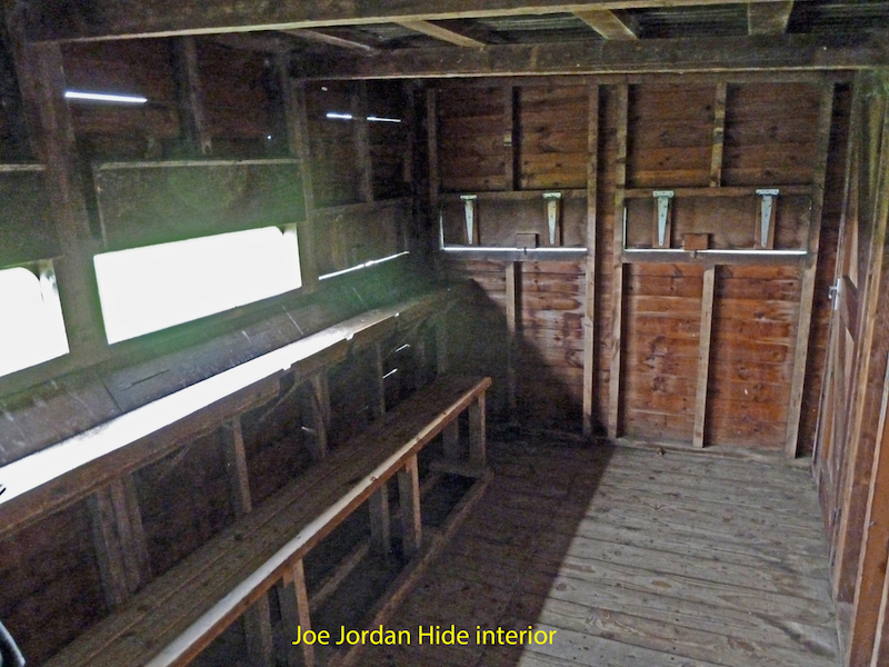
The Joe Jordan Hide gives some excellent views over parts of the grazing marsh, and some open water. On the day of survey a great white egret was showing well, with marsh harrier and buzzard also present. As with the Washington Hide views can be distant, and watching from this hide would benefit from the use of a telescope.